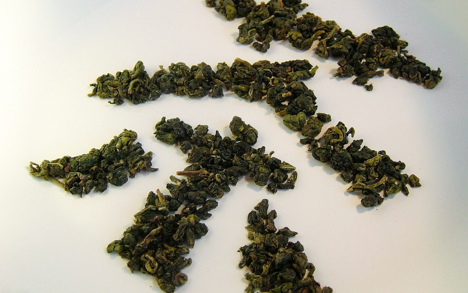
The county the mountain sits in
Alishan is a range in Chiayi County rather than a single peak, and the growing area spans a considerable altitude range within it.
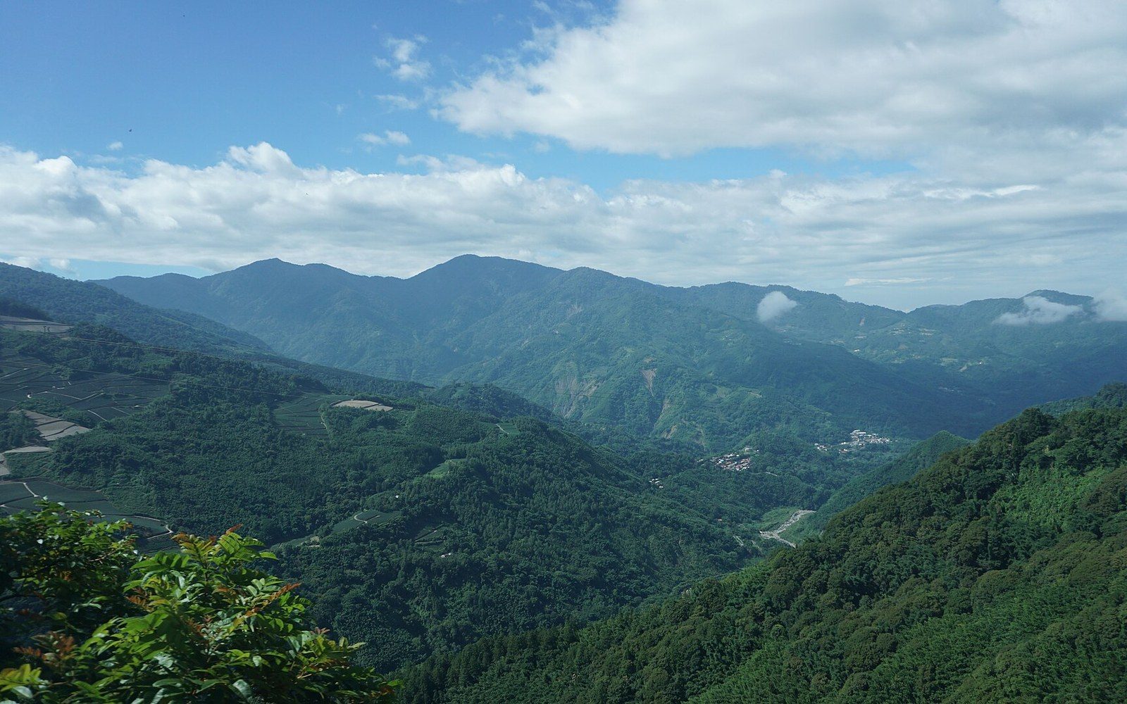
Alishan is not a summit. It is a range inside Chiayi County, and understanding the geography unlocks why the growing conditions vary so sharply across a short horizontal distance.
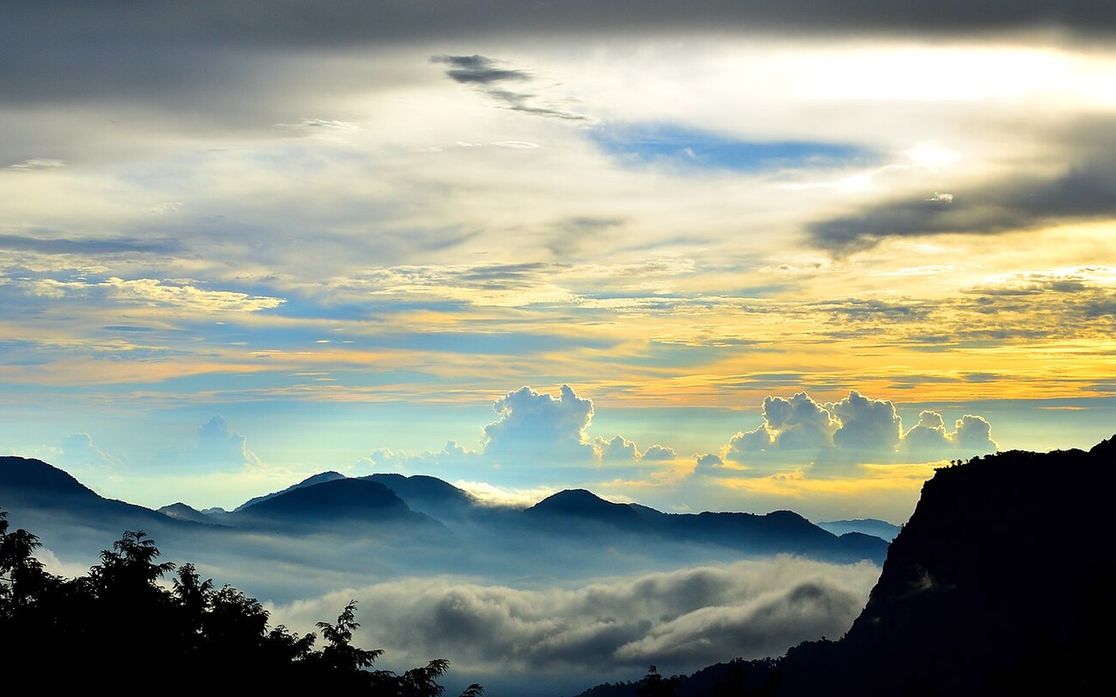
A County of Two Worlds
Chiayi County wraps around Chiayi City, running from the flat, densely farmed western plain all the way up into the Central Mountain Range on Taiwan's spine. The administrative boundary contains both of those worlds — lowland rice paddies and betel-nut groves at sea level, and cloud-wrapped tea gardens above a thousand metres — within a single jurisdiction. That range is not incidental to the county's character; it is what defines it. Few counties in Taiwan span a vertical distance so extreme, and that span is precisely why the name Alishan carries weight beyond its administrative borders.
Alishan itself is not a single peak. It is a collective name for a group of mountains in the southern reaches of the Central Mountain Range, none of them the dramatic isolated cone that the name might suggest to a visitor who arrives by train. The sunrise viewpoint in the area commonly called Alishan, Zhushan, sits at approximately 2,489 metres above sea level, and it is best known as a viewpoint for the sea of cloud below and the sunrise above it — a scene the Alishan National Scenic Area ↗ has been administered to protect since its formal designation. The rest of the massif fans out across a plateau of ridges, hollows and valleys, with the historic station town of Fenqihu at around 1,400 metres marking a kind of threshold on the way up: low enough to feel like a market town, high enough to catch the first tendrils of cloud.
What this means for agriculture is that "grown in Alishan" is not a single elevation statement. A farm at 800 metres on the lower slopes occupies a substantially different climate to one at 1,600 metres near the plateau. Temperature, humidity, cloud cover, diurnal range — the difference between warm and cold within a single day — all shift considerably across those 800 metres of altitude. For tea, that variation is not merely scenic. The slower cell growth that low night temperatures impose on a leaf is the mechanism behind the aromatic concentration that makes high-mountain oolong distinctive. The cloud that rolls in each afternoon reduces ultraviolet exposure and, in doing so, alters the balance of amino acids and polyphenols in the leaf. A garden at 1,200 metres is not simply a cooler version of one at 900 metres; it is operating in a meaningfully different regime.
The Growing Area and Its Altitudinal Logic
The broadly recognised high-mountain growing area within Alishan begins around 1,000 metres — the threshold commonly cited by Taiwan's agricultural classifications for the designation gaoshan cha, meaning "high-mountain tea." Below that line, the conditions still produce tea, but it does not qualify for the label that commands a premium and carries the implied promise of slower maturation. Above it, farms spread across the accessible ridgelines and bowl-shaped clearings that the topography allows, with the steepest terrain left under forest or bamboo. The Alishan range's mixed land cover — working farmland, forestry plantations, and remnant stands of the cypress and cedar the railway was originally built to extract — means that agriculture and ecology sit in close proximity throughout the zone.
That proximity matters for organic certification in particular ways. A certified farm on a ridge must account for what its neighbours are doing, and in a landscape this broken, that accounting is never simple. Buffer zones — unplanted margins or planted hedgerows that interrupt the drift of spray from conventional neighbours — are a certification requirement, and on steep terrain where water runs decisively downhill, the geometry of those buffers is determined as much by drainage as by property boundaries. An inspector mapping a farm's exposure to contamination risk is reading the contour lines as carefully as the cadastral plan.
Chiayi County's jurisdiction over this land matters because it determines which agencies and authorities are the first point of contact for farmers navigating Taiwan's certification system. Taiwan's Organic Agriculture Promotion Act, which came into full effect in 2019, unified a framework that had previously been fragmented, and certification under it is carried out by bodies accredited by the Council of Agriculture — now reorganised as the Ministry of Agriculture following a 2023 restructuring. A Chiayi County farmer seeking certification will deal with one of those accredited bodies, supply records going back through the three-year conversion period, and face an annual inspection that reviews inputs, mass-balance accounts, and residue data. The county government's agricultural extension services exist as a parallel resource, though they are distinct from the certification apparatus: guidance from an extension officer does not substitute for independent audit.
Altitude, Rainfall, and What the Maps Don't Show
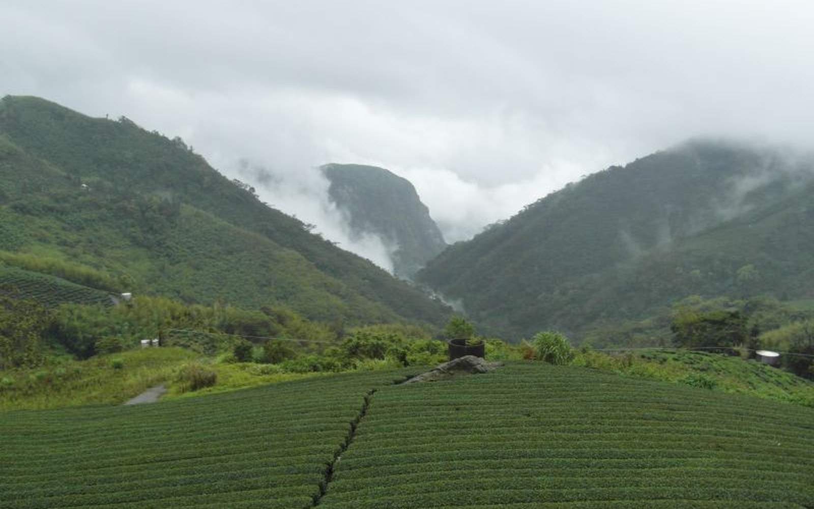
The county receives most of its rainfall between May and September, with the southwestern monsoon delivering substantial volumes to the lower slopes and the typhoon season adding irregular, intense events from summer into autumn. At higher elevation within Alishan, the cloud belt operates as a near-daily phenomenon independent of rainfall — mist that condenses on the vegetation and raises effective moisture even in otherwise dry periods. That cloud has agricultural consequences: it moderates maximum temperatures, slows evapotranspiration, and extends the effective growing season for slow-maturing varieties that would bolt or coarsen at lower altitudes.
What topographic and meteorological maps do not show easily is the patchwork of microclimates that valley orientation and slope aspect create across the massif. A north-facing garden in a hollow may experience fog for six hours after a south-facing ridge has cleared. A valley that channels cold air drainage at night can push temperatures low enough to stress plants that a farm half a kilometre away never encounters. These microclimatic differences are one reason that experienced buyers of Alishan tea track not just altitude but specific valley systems and processing dates — and why a certification document, which records the farm's location and management history, only begins to describe what the cup eventually contains.
The name Chiayi itself carries a history worth a sentence: it derives from a Chinese transliteration of a Taiwanese Hokkien rendering of a place name, layered through successive administrations. The county as it stands today was formed through local government reorganisations in the twentieth century, separating the county from the independent municipality of Chiayi City, which sits at its geographic centre. That administrative quirk — a county with a gap in its middle — is typical of the compressed, sometimes counter-intuitive geography of western Taiwan, where dense population and intensive land use have produced boundaries that read oddly on a map but make sense as political history.
For anyone reading an organic label from the Alishan area, the county of origin is the legal and administrative anchor. The range name gives the altitude story; the county name gives the regulatory one. Both are necessary, and neither alone is sufficient to understand what the certification is actually certifying or why the land that produces the crop looks, and behaves, the way it does.